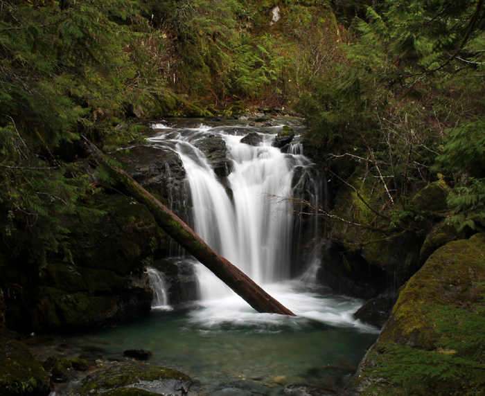
Smith Falls w/ large pool
A Waterfall Amphitheater on Champion Creek
Photographer: G. Price
Return to Cottage Grove
Home Page
GPS - Smith Falls viewpoint, 790m el.
Smith Falls, May, 5.1MB 480p 12.7 sec (source Grouse Mountain)
Month: January
Smith Falls is east of Cottage Grove.
- Consult with Cottage Grove Ranger Station (541-942-5591) for status
of Forest Service Road #22 (Brice Creek Road) before travel
- Take Cottage Grove exit 174
- Head east on Row River Road.
- Past milepost 4 continue straight onto Shoreview Drive
(Row River Rd splits off to the left - Shoreview Drive rejoins Row River Rd in another six miles)
- Past milepost 19 Row River Road ends. Head straight onto Brice Creek Road (FSR #22)
This road will have its own mileposts (road that veers left is FSR #17 to Spirit/Moon Falls)
- Near milepost 8 look for a rest area just before a bridge
(this is the same place to access Trestle Creek Falls)
- Turn right onto gravel Champion Creek Road (#2473) before the bridge
Smith Falls is 2.4 miles up Champion Creek Road. This road is not maintained for snow and ice.

There is no access to the base of the falls.
In addition, there are places where a four wheel drive vehicle is highly recommended (per the picture below).
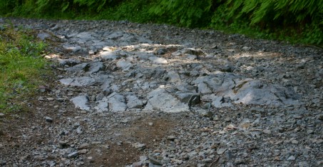
There are some places where you could pull off to the side of the road (well before this jaw-rattler) and hike the rest of the way.
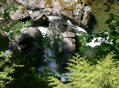
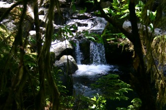
The scenery is also excellent before you reach the falls. I call the one on the left Triangle Rock due to the way it splits the water flow.
It is one half mile up Champion Creek Road.
Found this Northwestern Garter Snake just as it ducked behind some greenery along the road.
You can find its cousins at garter.htm
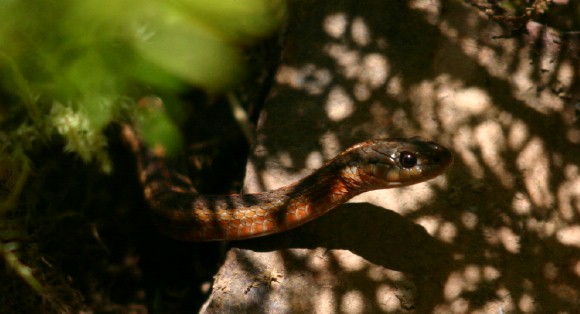
Photograph specifics: 1/1250 Second; Sports; aperture 5.6; ISO400; 125mm
Note: I saw some poisonous plants along Champion Creek Road called Digitalis (aka foxglove).
URL: https://www.oregonwaterfalls.net/smith.htm