National Creek Falls
Photographer: G. Price
Return to Diamond Lake South
Home Page
GPS - National Crk Falls, 1.18km el.
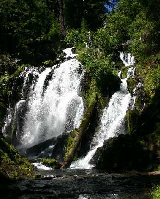
National Creek Falls is south of Diamond Lake.
Directions:
- On I-5 take Roseburg exit 124.
- Follow signs in Roseburg leading to Hwy 138 East.
- At milepost 83 on HWY 138 (past Diamond Lake) turn right to get onto HWY 230.
- At milepost six on HWY 230 turn east onto Road 6530 (marked by a
National Creek Falls sign and a county line sign).
- In 1.3 miles bear left at the fork in the road to remain on #6530
- In another 2.4 miles turn right at the sign for National Creek Falls.
- Parking area is one-tenth of a mile down the gravel road.
- Trail to falls is about half a mile with switchbacks.
There are no facilities.
URL: https://www.oregonwaterfalls.net/national.htm