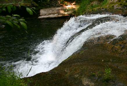
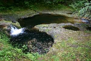
Portland Creek Falls Lower/Upper
Photographer: G. Price
Return to Oakridge
Home Page
GPS - Portland Creek Falls, Lower, 425m el.
GPS - Portland Creek Falls, Upper, 520m el.
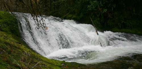
Portland Creek Falls' are west of Oakridge.
Directions:
- From I-5 take exit 188A for HWY 58
- At milepost 13 turn left at sign for Lowell (historic covered bridge to your left)
- After 0.8 mile turn left to stay on Jasper-Lowell road
- In 0.1 mile turn right at sign for Fall Creek (Jasper-Lowell Road)
- In another 1.8 miles turn right onto Big Fall Creek Road and reset your trip odometer
(you will see a second covered bridge here)
- Counting up a total of 15.7 miles on the trip odometer turn right onto paved Road 1825
- In another 2.3 miles turn left onto gravel Road 1835
- In 0.6 miles pull over to a wide spot on the right and find a trail down to the creek for the lower falls
- In another 1.9 miles (total 2.5 on 1835) pull over to a wide spot on the left just before a bridge (with '1976' cast into it)
- Portland Crk Falls (upper) is on the east side of the bridge and is accessible from a dirt road just before the bridge
Low Summer Flow at the lower falls
Can you see a duck? Hint: the waterfall is the beak.
Picnic/camping facilities on Big Fall Creek Road.
7.3 miles further up Big Fall Creek Road (total 23) you'll find Fall Creek Falls
URL: https://www.oregonwaterfalls.net/ulportland.htm