Waterfalls
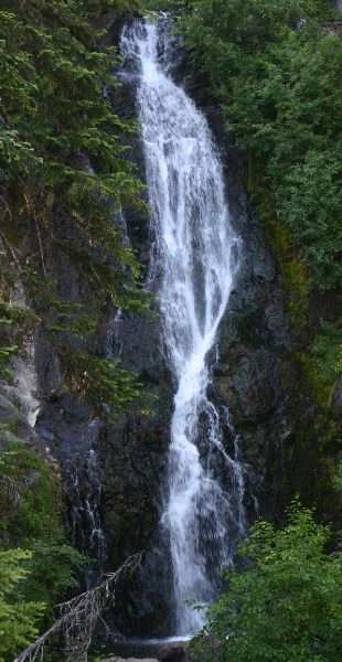
Umbrella & Sahale Falls
on East Fork Hood River
Photographer: G. Price
Return to Mt Hood
Home Page
GPS - Sahale Falls, 1.4km el.
GPS - Umbrella Falls, 1.6km el.
Umbrella Falls photograph specifics: speed 1/13, ISO100, lens 18mm, aperture 11, polarizer
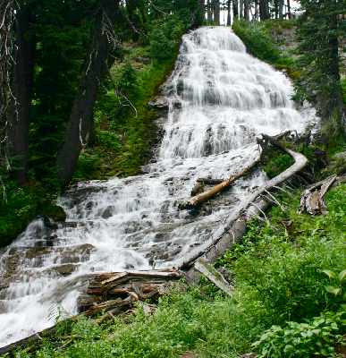
Sahale Falls
Umbrella and Sahale Falls are on the eastern flank of Mt. Hood.
Note: not to be confused with Sahalie Falls on HWY 126
Directions:
- From Interstate 205 take exit 12 and head east on HWY 212.
- HWY 212 will eventually meet up with HWY 26. Head east on 26.*
- Past Government Camp exit HWY 26 and head north on HWY 35.
- Near milepost 65 look for a "Sahale Falls Loop" sign.
- Turn left onto the road opposite the sign (note odometer reading).
- Follow the road left past the locked heavy equipment area and turn left
at the "Sahale Falls" sign a short distance away.
- From the first odometer reading find the 0.5 mile mark.
There will be a wide spot on the other side of the road to park.
Walk across the road and find the trail nearby.
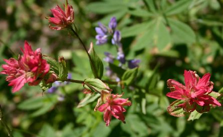
On the trail - Indian paintbrush and lupine
- Go up the trail for a little over a mile until you encounter a sign
with its text facing away from you. This is the sign for the trail you're on.
- Bear left at this sign and head up the trail for about half mile.
- Umbrella Falls is the first one to be reached.
- To find Sahale Falls head back down the trail and turn right at the sign
to go back to the access road.
- Sahale Falls is 0.6 miles up the road either by hiking or driving.
*The temptation would be to go to Exit 19 to get directly onto HWY 26 East (Division Ave.).
This would put you through a lot of lights. Then you would have to turn right
on Burnside to continue on HWY 26. Don't be a glutton for punishment.
URL: https://www.oregonwaterfalls.net/sahale.htm